Why Use Aerial Site Documentation?
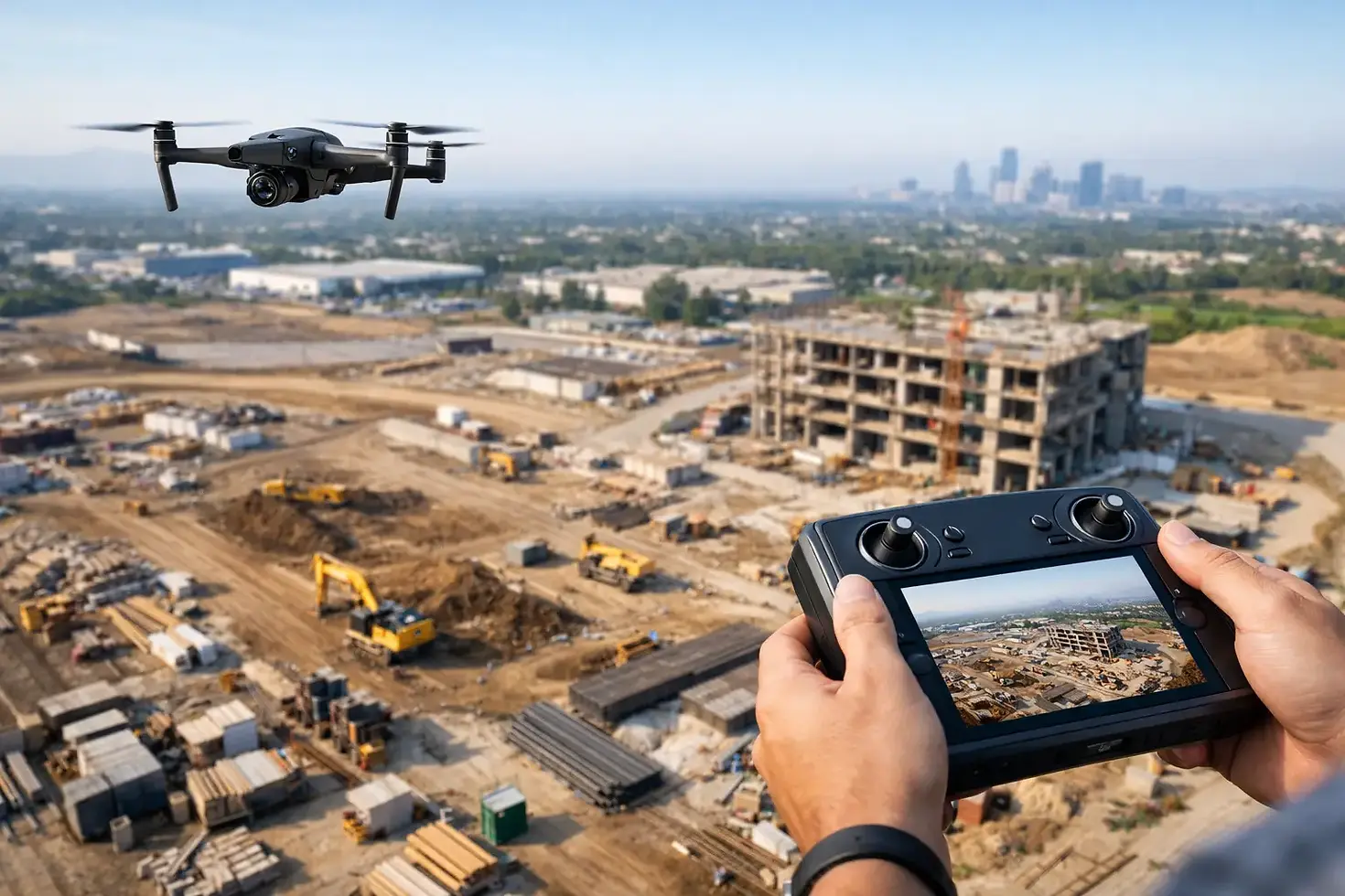
A site can look under control from the ground and still tell an incomplete story. On active construction sites, large properties, development parcels, and infrastructure projects, the biggest communication gaps usually come from limited visibility. That is exactly why use aerial site documentation becomes a practical question, not just a creative one. When stakeholders need to see scale, progress, layout, and site conditions clearly, overhead imaging gives them a faster and more accurate view.
Why use aerial site documentation for business projects
Aerial site documentation gives decision-makers perspective that ground photography rarely can. A drone can capture the full footprint of a jobsite, show how areas connect, and record changes over time from repeatable vantage points. For contractors, developers, property managers, engineers, and owners, that means fewer assumptions and stronger visual records.
The value is not limited to one phase of a project. Early on, aerial imagery helps establish baseline conditions. During active work, it supports progress reporting and coordination. After completion, it creates a polished record of the finished site for closeout files, stakeholder presentations, and marketing use.
This matters because many projects involve people who are not physically present every day. Investors, clients, leadership teams, board members, and remote partners still need to understand what is happening on the ground. Aerial documentation makes that easier without requiring long site walks or fragmented photo sets.
Better visibility leads to better decisions
Most site issues are easier to evaluate when the full context is visible. Ground-level photos can show detail, but they often miss relationships between structures, access roads, staging areas, drainage paths, equipment placement, and surrounding land use. An aerial image shows the whole picture in one frame.
That broader view helps teams identify whether operations match the plan. It can reveal traffic flow issues, material storage patterns, perimeter conditions, erosion concerns, and progress bottlenecks that are hard to recognize from eye level. Even when the answer is not obvious from a single image, aerial documentation creates a clearer starting point for discussion.
For large or irregular sites, this is especially useful. A commercial development, industrial property, utility corridor, or multi-building campus cannot be communicated well through scattered smartphone photos. Precision aerial imaging brings order to that complexity.
A stronger record of progress over time
One of the clearest reasons why use aerial site documentation is consistency. When imagery is captured at planned intervals, teams can compare progress from one date to the next with far less guesswork. That creates a reliable visual timeline of the project.
This is useful in weekly updates, monthly owner reports, lender communications, and internal reviews. Instead of describing progress in broad terms, teams can show site changes directly. Slab work, framing, grading, utility installation, paving, landscaping, and final site completion become easier to track when each stage is documented from a similar height and angle.
Consistency matters more than many teams expect. Random photos taken only when someone remembers to take them rarely create a useful archive. Scheduled aerial documentation produces a cleaner historical record, and that record can support both day-to-day communication and long-term accountability.
Clearer communication with clients and stakeholders
Projects often slow down when people are not looking at the same information. Aerial visuals reduce that friction. They give non-technical stakeholders a quick, understandable view of site status without requiring them to interpret plans, field notes, or dense reporting language.
For client-facing communication, this makes updates more persuasive and easier to trust. For internal teams, it reduces time spent explaining what happened where. A well-captured overhead image can answer questions before they turn into back-and-forth emails.
This applies beyond construction. Commercial property owners can use aerial documentation to communicate maintenance scope, land conditions, roof access context, parking layout, and site improvements. Developers can present parcel readiness or infrastructure progress. Organizations managing physical assets can document change in a way that is easy to share across departments.
Documentation that supports reporting and accountability
Site documentation is not only about visibility. It is also about proof. Projects create ongoing demands for records, whether for owners, investors, insurance discussions, compliance needs, or operational review. Aerial imagery gives businesses date-specific visual documentation that can strengthen those records.
That does not mean drone media replaces all forms of documentation. Field reports, plans, inspections, and close-up photography still matter. But aerial coverage adds an important layer by showing the site as a whole at a given point in time. In many cases, that broader visual record helps explain conditions more effectively than text alone.
There are trade-offs, of course. Aerial documentation is strongest when it is planned and captured professionally. Weather, flight restrictions, and site activity can affect timing. And while overhead imagery is excellent for context, it may need to be paired with ground-level detail for specific technical issues. The best approach is usually a mix of both.
Why use aerial site documentation instead of only ground photos
Ground photography still has a place. It captures finishes, defects, equipment details, and close-range conditions that matter on any serious project. But if a team relies on ground photos alone, they often end up with fragmented coverage that lacks geographic context.
Aerial documentation fills that gap. It shows where the work sits within the site, how large the area really is, and how different project zones relate to each other. That is hard to replicate from the ground, especially on large tracts, active construction sites, or properties with multiple structures.
The difference is not just visual appeal. It is clarity. Aerial imaging helps viewers understand orientation immediately. That is why it works so well in reports, presentations, planning discussions, and promotional materials. People can see the site, not just isolated pieces of it.
Useful beyond operations and into marketing
Aerial site documentation has a second advantage many businesses overlook. The same photo and video assets used for reporting can often support external presentation. Completed projects, improved properties, and active developments all benefit from visuals that show scale and professionalism.
For contractors and developers, this can strengthen project portfolios and bid support materials. For commercial real estate and property stakeholders, it can improve listing packages, leasing presentations, and investor updates. For organizations with public-facing projects, it helps communicate progress in a polished, credible format.
This dual-use value matters because it increases the return on each shoot. Instead of treating documentation and promotion as separate efforts, businesses can build a visual library that serves both operational and presentation goals.
What makes aerial documentation effective
Not every drone shoot produces useful documentation. Effective aerial site coverage depends on consistency, image quality, timing, and purpose. If the goal is progress tracking, the footage should be captured from repeatable positions. If the goal is stakeholder reporting, the imagery should prioritize clarity over flashy movement. If the goal is both documentation and presentation, the deliverables should be structured accordingly.
That is where a professional provider makes a difference. Precision matters in how the site is framed, how changes are recorded, and how the visuals are delivered for actual business use. Aerial media should not create more sorting, guessing, or editing work for the client. It should simplify communication.
For businesses in North Alabama, local familiarity can help as well. A provider who understands regional project types, site conditions, and client expectations is better positioned to produce images that are immediately useful, whether for construction tracking, property documentation, or polished promotional content.
When aerial site documentation makes the most sense
Aerial documentation is especially valuable when the site is large, the project changes quickly, multiple stakeholders need updates, or the property needs to be presented clearly to people who are not onsite. It also makes sense when teams want stronger records from the start instead of trying to reconstruct the visual history later.
For smaller properties or one-time needs, a single flight may be enough to establish a baseline or capture completion. For longer projects, recurring flights usually create the most value because they turn isolated images into a documented progression.
The right frequency depends on the pace of work, reporting requirements, and the reason the imagery is being captured in the first place. Some projects need monthly updates. Others benefit from milestone-based documentation tied to key phases.
PRB Media LLC approaches this work with a clear focus: precision aerial imaging that gives businesses better visibility, stronger documentation, and usable visuals from above. When a site needs to be understood quickly and communicated clearly, the best view is often the one that shows everything in relation.
A project moves faster when everyone can see what is actually happening. That is the real case for aerial site documentation - fewer blind spots, clearer records, and visuals that keep the work moving forward.


Comments